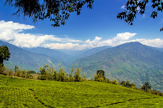
Meghalaya (Abode of Clouds in Sanskrit) is one of the seven Northeastern states of India.
Meghalaya is famous for its high rainfall, subtropical forests and biodiversity.
During the British rule of India, the British imperial authorities nicknamed it the "Scotland of the East".
Meghalaya was previously part of Assam, but on 21 January 1972, the districts of Khasi, Garo and Jaintia hills became the new state of Meghalaya.
Shillong
Shillong is a hill station and capital of the state of Meghalaya.
It’s known for the manicured gardens at Lady Hydari Park. Nearby, Ward’s Lake is surrounded by walking trails.
North, the Don Bosco Centre for Indigenous Cultures features displays on the region’s native people. Waterfalls include the Elephant Falls to the southwest. East of here, forested Shillong Peak offers city views.
Cherrapunjee
Cherrapunjee, also known as Sohra.
It's known for its living root bridges, made from rubber trees.
To the northeast, Mawkdok Dympep Valley View Point overlooks verdant gorges. In the surrounding hills, the Noh-Kalikai, Dain-Then and Kynrem waterfalls plunge from forested clifftops. South of town, Mawsmai Cave is illuminated to show its stalagmites.
Mawsynram
Mawsynram is a village in the East Khasi Hills district of Meghalaya, 65 kilometres from Shillong.
Mawsynram receives one of the highest rainfalls in India.
Jowai
Jowai is the headquarters of West Jaintia Hills district of the state of Meghalaya, India and is home to the Pnar tribe.
Jowai is a scenic place located on a plateau surrounded on three sides by the Myntdu river bordering Bangladesh to the south.
Baghmara
It has a famous river Someshwari also known as Samsung in Garo tribal language flowing through its expanse and is also covered in hills and tracts along the way.
Dawki
Dawki is known for its pristine lush green surroundings, and it is truly a blessing in disguise! The town is not just a tourist attraction but also one of the nearest 'Gateways to Bangladesh'.
Dawki river is the most cleanest river in the world.
•Best time to visit Dawki for Solo - January, June, July
• Best time to visit Dawki for Couple - September, October, November
• Best time to visit Dawki for Family and Friends -February, June, July
Double Decker living root bridges
The most popular tourist attraction of Cherrapunjee, these double-decker living root bridges are 2 bridges that are stacked one on the other, made because of the entanglement of roots.
A new root bridge takes about 15 years to get strong enough so that it can bear the weight of people who would be crossing it.
The Khasi people do not know when or how the tradition of living root bridges started. The earliest written record of Sohra's (Cherrapunji's) living root bridges is by Lieutenant Henry Yule, who expressed astonishment about them in the 1844 Journal of the Asiatic Society of Bengal.
Mawsmai Cave
Revered as one of the most popular and notable landmarks in Cherrapunji is Mawsmai cave. The striking natural cave is flocked by visitors in great numbers.
It is one of the best places for history buffs and experience seekers. The Mawsmai cave in Cherrapunji boasts of the wide and amazing entrance with the dark and magical mystery inside. The limestone constructions of the cave would surely leave you fascinated.
Getting inside the cave you can see constant dripping of water from the roofs of the cave and the formation of stalactites and stalagmites. Further, with great observations, you can also note how the roof and the floor of the cave are joined together to form the iconic pillars. Moreover, some openings of the cave are quite large but some are so small that one has to kneel down and bend their heads. Although the entrance is quite large, the exit is small. It is a great fun to be at Mawsmai cave in Cherrapunji. Do not forget to take pictures as it is a lifetime opportunity.
Nohkalikai Falls
Nohkalikai Falls is the tallest plunge waterfall in INDIA.
Its height is 1115 feet (340 metres). The waterfall is located near Cherrapunji, one of the wettest places on Earth.
Nohkalikai Falls are fed by the rainwater collected on the summit of a comparatively small plateau and decrease in power during the dry season in December - February.
Below the falls there has formed a plunge pool with unusual green coloured water.
Elephant Falls
Elephant Falls was the British name of what the local Khasi people once referred to as Ka Kshaid Lai Pateng Khohsiew (or "Three Steps Waterfalls") since the falls actually consisted of three sections in succession.
I learned from a sign here that the British renamed the falls because there used to be a rock resembling an elephant near the left side of the main falls (which I think was the bottommost one). However, that rock was destroyed in an earthquake back in 1897.
Umiam Lake
Umiam Lake is also called Barapani lake.
It was created by damming the Umiam River in the early 1960s. The principal catchment area of the lake and dam is spread over 220 square km.
How to reach Meghalaya?
The nearest railway station is Guwahati. It is 104 km from Shillong and very well connected with all major cities of India. Meghalaya Transport Corporation (MTC) has bus services coordinated with train arrivals at Guwahati. The buses leave Guwahati beginning 6 am till 5 pm (three and a half hrs).


Nice
ReplyDeletefantastic place
ReplyDeleteNice
ReplyDeletegood but it could be more good if u add more info about food and travel cost
ReplyDeletevery nice
ReplyDelete